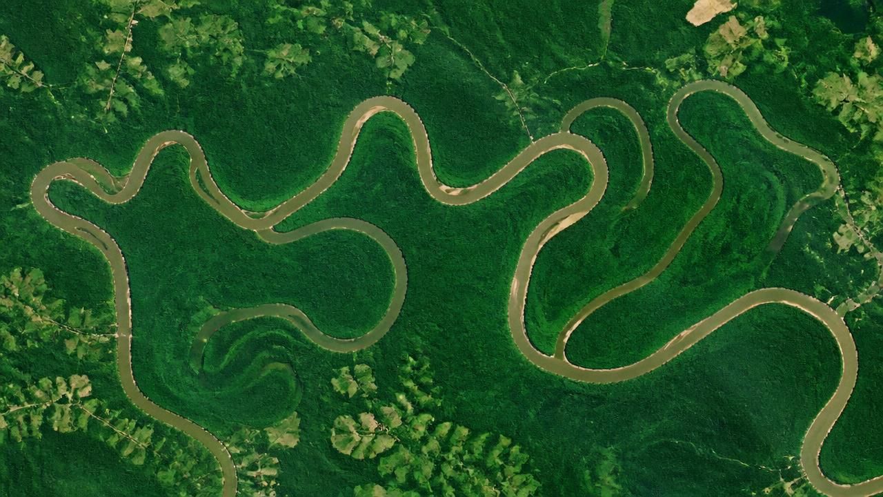
When NASA's Landsat 9 satellite passed over South Carolina on August 18, 2025, its Operational Land Imager (OLI) captured a striking image of the Congaree River winding through a sea of green. The scene, released by NASA's Earth Observatory, showcases Congaree National Park—a place where 80 percent of the park lies within the river's floodplain, making it one of the most river-defined landscapes in the entire U.S. national park system.
"Among the 63 U.S. national parks, few are as defined by a single river’s floodplain as Congaree National Park," NASA wrote.
The image is more than a pretty picture. It reveals the intricate geography of the park: curving bands of green trace ancient channels, ridges, and swales left behind as the river migrated across the plain. These subtle elevation differences dictate how often each area floods, creating a patchwork of ecosystems that supports one of the largest intact tracts of old-growth bottomland hardwood forest in the United States.
The Floodplain's Dynamic Heart
Congaree's floodplain is a living laboratory. Scientific studies, including research published in AGU journals, have explored the geomorphology and surface-water circulation dynamics of the Congaree River. These studies show that seasonal flooding is not a disturbance but a life-giving force. Water spreads nutrients across the forest floor, nourishing towering oaks, cypress, and tupelo trees that can reach heights of over 150 feet.
The National Park Service (NPS) operates an active research program at Congaree, monitoring everything from water quality to wildlife. Recent projects highlighted by NPS include:
- Feral hog management – Invasive hogs threaten the park's delicate soils and rare plants, and NPS is studying their impact.
- Bachman's warbler searches – The park has been a focus for birders hoping to rediscover this possibly extinct species, with documented search efforts.
- Liana research – Woody vines, often overlooked, are being studied for their role in forest dynamics.
- Bat and moth interactions – A collaborative study with the park's Research Learning Center is uncovering how these species interact in the old-growth forest.
- Synchronic firefly research – Congaree is one of the few places where synchronous fireflies flash in unison, drawing crowds each spring.
- Carolina bogmint monitoring – This rare plant is a conservation priority, and researchers are tracking its fragile populations.
Threats and Challenges
Despite its ecological riches, Congaree faces a range of pressures. The Post and Courier, a South Carolina newspaper, recently reported on the park's struggle against pollution, political challenges, and an unfair reputation as the "worst national park" in the country. Critics have derided it as a "swamp" with few iconic vistas, but defenders argue that its dense, flat landscape requires a different kind of appreciation—one that values biodiversity and wildness over dramatic scenery.
The park is also designated a UNESCO Biosphere Region, a title NPS celebrates as the "Green Heart of South Carolina." Yet, as the post-and-courier story notes, the park must constantly fight for resources and public perception. Water pollution from upstream agricultural runoff and development remains a persistent concern, and the invasive feral hogs add to the management burden.
A Hidden Gem for Visitors
For travelers, Congaree offers a unique experience. Thrillist recommends visiting in winter, when the park floods—an event that transforms the forest into a surreal, canoeable landscape. "This National Park Floods in Winter—and That's Precisely When You Should Visit," the outlet proclaims. Drone videos posted on MSN describe the park as "America's hidden forest" and "America's forgotten forest," capturing its untouched beauty from above.
Mental Floss includes Congaree on its list of 7 "Hidden Gem" National Parks to visit this summer, noting its boardwalk trails and towering trees. World Atlas ranks it among South Carolina's must-visit parks, and also warns that the state is home to snake hotspots and alligator-filled swamps—though these inhabitants are part of the park's wild appeal. For those seeking a quieter alternative, Only In Your State even suggests a nearby state park that feels like a less-crowded Congaree.
The Science of the Scene
NASA's satellite imagery is more than aesthetic; it's a scientific tool. By comparing the August 2025 image with older data, researchers can track changes in floodplain vegetation, river course migration, and the effects of floods and droughts. The contrasting shades of green in the false-color image correspond to different forest communities—some wetter, some drier—allowing scientists to map the invisible hydrology of the park.
Why It Matters
Congaree National Park stands as a testament to the power of water and the resilience of nature. It's a place where the line between river and forest blurs, where flooding is not a disaster but a ritual of renewal. As climate change intensifies rainfall and storm surges, understanding floodplain dynamics becomes ever more critical. The research happening at Congaree—from satellite tracking to ground-level wildlife surveys—offers insights that could help protect floodplain forests worldwide.
Whether you paddle through its flooded winter woods, hike its boardwalks in summer, or simply admire it from space, Congaree invites a deeper appreciation. As one NASA observer put it, this is a park defined not by mountains or canyons, but by the gentle, persistent force of a river and the forest that grew up around it.