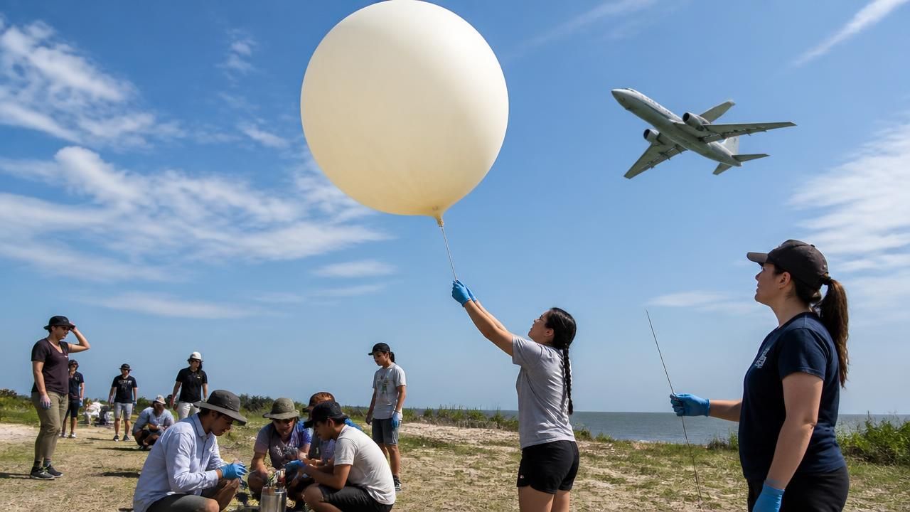
This summer, NASA's fleet of research aircraft and balloons took to the skies in a coordinated push to study Earth's atmosphere, oceans, and ecosystems. At the heart of this effort is a new generation of student researchers — 48 undergraduates who participated in NASA's Student Airborne Research Program (SARP), culminating July 27 on the gusty Texas Gulf Coast. There, a dozen students from the program's atmospheric science group released ozonesondes — scientific instruments attached to large helium balloons — to measure ozone concentrations as they rose through the atmosphere.
A Hands-On Approach to Earth Science
For the students, the experience was a far cry from typical classroom learning. Guided by instrument scientists, university professors, and graduate students, the SARP participants chemically treated instrument cells, wrangled balloons during inflation, and released them into the sky, monitoring real-time data as the balloons ascended. "This research program is a unique experience for students where they have the opportunity to see the different careers related to Earth system science," said Yaitza Luna-Cruz, program manager for NASA's Early Career Research Program at NASA Headquarters in Washington.
The students were assigned to one of four disciplines — atmospheric science, oceans, terrestrial ecology, or hydrology — each involving hands-on fieldwork. The program's goal is to immerse undergraduates in the full cycle of scientific investigation, from data collection to analysis and presentation.
Low-Flying Planes Over American Cities
While SARP students were launching balloons in Texas, residents of Houston and Philadelphia were seeing another side of NASA's airborne science: low-flying research planes. Local news outlets reported that NASA aircraft would be flying at low altitudes over the Houston area starting Wednesday, and over the Philadelphia region for the week. The flights are part of NASA's Earth science campaigns, which use specially instrumented aircraft to take detailed measurements of surface and atmospheric processes.
Often, these flights are mistaken for military operations or emergencies. But NASA has been flying such missions for decades, using aircraft equipped with radar, spectrometers, and other sensors to study everything from soil moisture to air quality. The Houston flights, for example, were likely tied to coastal and atmospheric research over the Gulf of Mexico, complementing the balloon launches happening nearby.
"Airborne science is a critical component of NASA's Earth observation strategy," said a NASA spokesperson. "These platforms allow us to study processes at a scale and resolution that satellites alone cannot achieve."
A Busy Year for Airborne Fieldwork
NASA's Earth Science Division has a packed agenda of airborne campaigns this year, according to announcements from the Jet Propulsion Laboratory and other centers. While specific details are often locked behind technical gateways, the titles alone reveal a sweeping range of investigations:
- Arctic Sea Ice — scientists took to the air and space to monitor changes in polar ice.
- Wildfire data — an airborne sensor provided real-time information to help firefighters.
- Wildflowers and pollinators — research linking plant biodiversity to airborne imaging.
- Coral reefs — testing observing capabilities over Hawaii's reefs to assess bleaching and health.
- Landslides — radar imagery revealed details about Los Angeles-area hillslope movements.
- Atmospheric rivers — a JPL sensor studied "rivers in the sky" that bring heavy rainfall.
These campaigns often fly in coordination with satellite overpasses, providing "ground truth" data that helps calibrate spaceborne instruments. For example, a recent project called SHIFT (Surface Biology and Geology High-Frequency Time Series) sent researchers to California's Dangermond Preserve to collect plant samples that will be compared with airborne imaging spectroscopy data.
Forests in Gabon and Global Collaborations
NASA's airborne science is not confined to U.S. borders. Alongside partner space agencies, NASA measured forests in Gabon, Africa, using lidar to estimate biomass and carbon storage. The data from that campaign will help refine global climate models and inform forest management policies. Similarly, a campaign in California's diverse ecosystems is helping scientists protect habitats by combining remote sensing with field surveys.
Educational Impact and the Next Generation
The SARP program is one of several NASA initiatives aimed at training future scientists. At the University of Houston, a recent article highlighted how the program gives students "a new perspective on environmental research from the air and ground." For undergraduates like those at UCCS, earning a spot in SARP is a prestigious achievement and a stepping stone to a career in STEM.
NASA also recognizes individual contributions: UC Irvine atmospheric chemist Dr. Zhang recently received NASA's Exceptional Public Service Medal for her work in atmospheric chemistry, underscoring the importance of mentorship and research excellence in the field.
Why This Matters
As climate change accelerates, the need for detailed, local-scale environmental data becomes more urgent. Airborne campaigns fill critical gaps in our understanding of how Earth's systems are responding. They provide data that helps communities prepare for wildfires, floods, and sea-level rise; they help scientists track biodiversity loss; and they inspire students to pursue careers in science and engineering.
For the public, seeing a low-flying NASA plane or a weather balloon may be a fleeting curiosity, but behind each flight is a rigorous scientific investigation aimed at solving some of the most pressing challenges of our time. And with programs like SARP, NASA is ensuring that the next generation of researchers will be ready to continue that work.