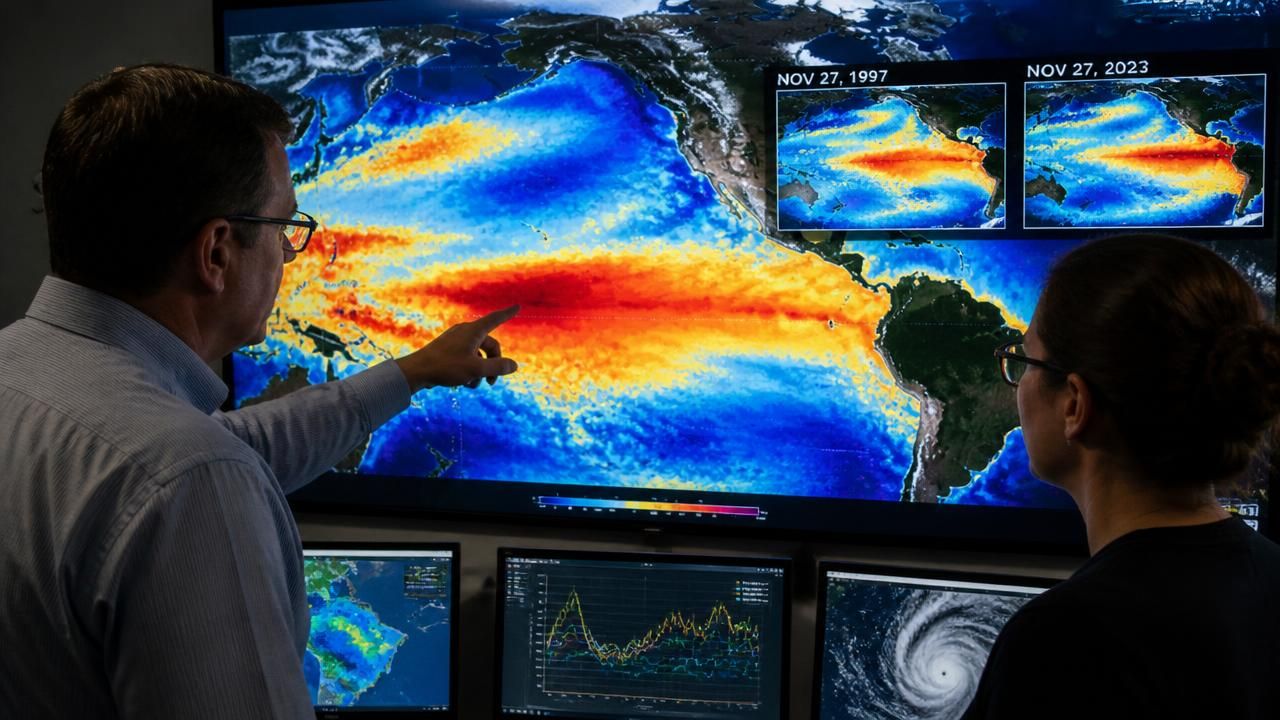
NASA scientists are warning that the El Niño pattern now rapidly intensifying across the equatorial Pacific could match — or even surpass — the 1997-98 event, the benchmark by which every "monster" El Niño since has been measured. Satellite observations of sea-surface temperatures, trade winds and ocean heat content reveal what researchers describe as striking structural similarities between the two events, raising the prospect of major rainfall and flooding in the months ahead. But the agency is equally clear on the limits of the comparison: similar setup does not guarantee similar outcome, and the precise regional impacts remain stubbornly uncertain.
A Satellite Mirror of 1997
The centerpiece of the NASA warning is the ocean itself. El Niño — the warm phase of the El Niño–Southern Oscillation (ENSO) — begins when weakened equatorial trade winds allow warm surface water to slosh eastward across the Pacific, dragging the atmospheric engine known as the Walker circulation with it. That reorganization reroutes storm tracks worldwide, and it is the reason a patch of ocean thousands of kilometers from any populated coastline can dictate whether Indonesia burns or Peru floods.
According to the NASA analysis, this year's event is developing along a trajectory that maps closely onto the 1997-98 season, widely regarded as the strongest El Niño of the twentieth century. In that event, sea-surface temperature anomalies in the key Niño 3.4 monitoring region peaked at roughly 2.4°C above average, and the resulting weather extremes — drought and fire across Indonesia and Southeast Asia, torrential flooding along the coasts of Ecuador and Peru, a sodden California winter, coral bleaching across the tropics — were linked to damages, insured losses and economic disruption commonly estimated in the tens of billions of dollars.
"Satellite data reveal striking similarities between the two, raising the possibility of major rainfall and flooding this winter, although the exact impacts remain uncertain." — NASA scientists, as reported by ScienceDaily
That closing caveat carries real scientific weight. ENSO forecasting is a probabilistic enterprise, not a deterministic one. Two El Niños of identical amplitude can produce markedly different outcomes depending on where the warmest water pools, how the Madden-Julian Oscillation behaves, and what other modes of climate variability — from the Indian Ocean Dipole to the Arctic Oscillation — happen to be doing at the same time.
From 'Godzilla' to 'Monster': A Naming History
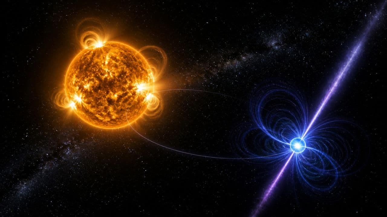
The language itself has become part of the story. The "Godzilla El Niño" label, popularized by NASA Jet Propulsion Laboratory climatologist Bill Patzert ahead of the powerful 2015-16 event, migrated from the lab to the front page and stuck — a shorthand for an anomaly that peaked near 2.3°C in the Niño 3.4 region. This year's coverage has leaned on the same vocabulary: "monster," "super" and "Godzilla" now function as a rough informal scale of public alarm.
Explainer journalism has grown up around the terms, with outlets fielding recurring questions about what distinguishes a run-of-the-mill El Niño from one that earns a monster-movie nickname, and about how La Niña — the cooling counterpart — fits into the same cycle. ScienceDaily, for instance, maintains standing El Niño and La Niña news hubs that aggregate research findings as the science evolves, a sign of how closely readers now track a phenomenon once confined to technical journals.
Audience interest beyond the numbers
Other outlets have taken a more visual route. MSN's coverage assembled side-by-side photography from 1997 and 2026 to dramatize the sheer scale of the current event, translating raw anomaly data into something a general audience can feel. The contrast between those approaches — NASA's instrument data on one side, the photo essay on the other — illustrates a broader shift in how climate science reaches the public: the same story told through numbers, images and nicknames simultaneously.
What's at Stake
If the 2026 event tracks the 1997-98 template, the historical record suggests several regions should be on heightened alert:
- Southeast Asia and Indonesia: suppressed monsoon rainfall, drought, and heightened wildfire risk across peatlands and forests.
- Peru and Ecuador: violent coastal flooding and landslides driven by anomalously warm coastal waters.
- California and the U.S. Southwest: atmospheric river activity that can deliver heavy winter precipitation — welcome relief in dry years, a flood hazard in wet ones.
- The northeastern United States: historically warmer, less snowy winters.
- Tropical reefs and fisheries: coral bleaching and disrupted marine food webs as warm water spreads.
- The Sahel and southern Africa: rainfall anomalies that can cut both ways depending on the timing of the event's peak.
Why the Uncertainty Matters
The gap between "this could be bigger than 1997" and "here is what will happen where you live" is where the real story sits. Scientists are increasingly able to forecast an El Niño's amplitude months in advance; they are far less able to forecast which regions get a soaking and which get a drought. Infrastructure planners, emergency managers and agricultural forecasters are therefore being asked to prepare across a wide range of plausible scenarios rather than a single expected one.
There is also the climate-change backdrop. Researchers caution that ENSO's variability does not switch off in a warming world; a strong El Niño is superimposed on a steadily rising temperature baseline. Even an event of 1997-98 amplitude would now play out against warmer oceans and a moister atmosphere — a combination that generally tilts the odds toward heavier extreme rainfall while complicating simple historical comparisons.
The Bottom Line
NASA's message is neither to panic nor to shrug. The satellite record has done what it does best: it has flagged an event of exceptional magnitude, identified its closest historical analogue, and set a watching brief. The coming months will determine whether 2026 earns a place beside 1997 in the record books, or merely near it — a distinction with serious consequences for farmers, coastal communities, water managers and fire agencies across the Pacific basin.