Two independent lines of scientific inquiry are converging on the same conclusion: humanity's imprint on the planet's water is no longer subtle, and it can now be measured — from orbit, and at the molecular level.
NASA's Earth Observatory this week published a new analysis drawn from more than two decades of satellite gravity measurements, showing where human activity has become a dominant driver of how water moves through lakes, rivers, soil and the subsurface. Separately, researchers at Florida State University have completed a review documenting the "molecular fingerprints" of human impacts on global water systems — work amplified in coverage by MSN and Newswise. Together with a broader body of climate-attribution research described by Phys.org as tracing human influence "from the top of the atmosphere to the bottom of the ocean," the findings form one of the most comprehensive portraits yet of a hydrologic cycle under pressure.
Weighing the Water From Space
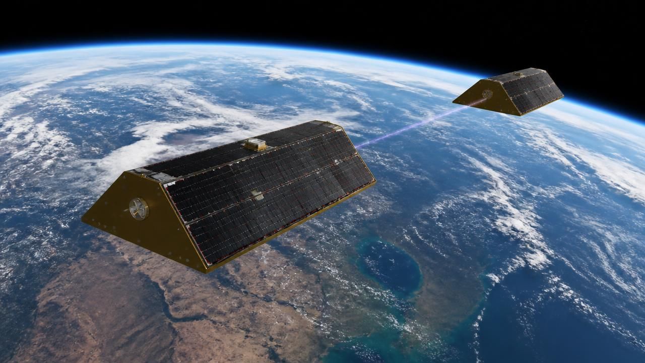
The NASA analysis rests on the GRACE (Gravity Recovery and Climate Experiment) mission and its successor, GRACE-FO. Launched in 2002 and 2018 respectively, the twin-satellite systems measure minute variations in Earth's gravitational field caused by the redistribution of mass — most importantly, water. The result is a global record of terrestrial water storage: the total water held in aquifers, soil moisture, snowpack, lakes and rivers.
The new map, produced by NASA Earth Observatory based on data from O'Neill, M.M., et al., depicts changes in terrestrial water storage from April 2002 to November 2025, expressed as the average annual change in equivalent water depth. Areas outlined in black indicate where those trends showed strong associations with human activities.
"Humans are exerting increasing influence over how water moves through lakes, rivers, soil, and the subsurface," the NASA study states, noting that researchers identified 40 regions where trends were strongly linked to human influence beyond the effects of natural climate variability.
That distinction — separating human-driven change from climate variability — is the analytical heart of the work. Droughts, wet years and long-term precipitation shifts all move the needle on water storage. The outlined regions are where the signal cannot be explained by weather alone.
Molecular Clues in the Water Itself
Where GRACE detects mass, the Florida State University review detects chemistry. According to coverage of the review, researchers catalogued the molecular signatures that human activity leaves in water systems worldwide — traces that range from isotopic ratios altered by evaporation and irrigation to synthetic compounds, nutrients and contaminants that have no natural counterpart.
The two approaches are complementary rather than competing. Satellite gravimetry offers global coverage and a continuous two-decade record, but it measures only totals — it can show that a region is losing water without saying precisely why. Molecular fingerprinting provides the mechanistic evidence: whether water has been pumped from deep aquifers, routed through irrigation canals, contaminated by industrial runoff or altered by wastewater return flows.
The framing across outlets reflects those differing strengths. NASA's Earth Observatory presentation is geophysical and visual, built around a single global map and the attribution question of where human hands are visible. The FSU and Newswise coverage emphasizes the chemistry and the synthesis of a sprawling literature, casting the story as a review of evidence rather than a single dataset. Phys.org's treatment takes the widest lens, presenting the findings as part of a unified field of climate fingerprinting that spans the entire Earth system.
From the Stratosphere to the Seafloor
That broader context matters. Climate "fingerprinting" — the practice of identifying patterns that are uniquely characteristic of human forcing rather than natural variability — has become one of the most robust tools in climate science. The same logic that reveals a warming troposphere alongside a cooling stratosphere has been extended to ocean heat content, sea-level rise, ice-sheet mass loss and now, with the new work, to the terrestrial water cycle.
- Space-based gravimetry provides a continuous global ledger of water mass since 2002.
- Molecular and isotopic tracers identify the specific processes responsible for local change.
- Attribution studies separate human influence from natural climate variability statistically.
- Model–observation comparisons, highlighted in separate MSN coverage, confirm that climate models reproduce the observed human influence.
Why It Matters
The stakes are practical. Terrestrial water storage is the freshwater reservoir that agriculture, industry and cities draw upon. Regions where human activity is the dominant driver of change are, by definition, regions where management decisions — not rainfall — will determine future water availability. Groundwater depletion in particular is effectively irreversible on human timescales, as aquifer compaction permanently reduces storage capacity.
The implication cuts both ways: the fingerprints are evidence of impact, but they also constitute a measurement system. If human activity is what is moving the water, then human policy is what can move it back.
What Comes Next
Researchers are pushing both techniques further. Continued GRACE-FO operations extend the record; planned successors aim to sharpen spatial resolution enough to resolve individual aquifer systems. On the molecular side, the FSU review's synthesis points toward standardized tracer suites that could be deployed in routine water-quality monitoring.
For now, the message from the data is unambiguous. From the gravity field thousands of kilometres above the planet to the dissolved compounds in a well a hundred metres down, the signature of human activity is written into the water — and scientists have learned to read it.